What is the “Jamaica Bay Community Flood Watch Project”?
The “Jamaica Bay Community Flood Watch Project” is a pilot initiative that uses citizen science to report flooding events in the Jamaica Bay watershed. Using photographs and reports collected by trained community members can help researchers visualize how “normal” high tides could look in the future due to sea level rise, as well as improve the science and computer models of flooding. These images and community knowledge can also help city leaders understand and grasp what is happening in coastal communities who may not be aware of what is happening on-the-ground.
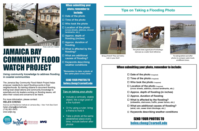
Residents can help improve forecasts of flooding and coastal hazards by documenting how and where floods occur and what impacts accompany them. Together, we can start to understand how floods and rising sea levels will impact local resources and community investments.
By training citizens to document flooding, local observations and community knowledge are shared with scientists and city leaders working on flooding issues, allowing community voices and concerns to be considered and heard.
For more information, please contact kag247@cornell.edu or 718-951-5415. Also, visit www.srijb.org/jbfloodwatch.
Useful links, tools, information:
Stevens Institute of Technology Flood Advisory System
National Weather Service New York, NY Coastal Flooding
New York City Emergency Management, Plan for Hazards
New York City Planning, NYC Flood Hazard Mapper